“Epic!” “Unforgettable!” These were some of the descriptions my co-conspirators (5 riders and 2 drivers) offered to describe this 8-day cycle tour along the back roads of the Baviaanskloof and Swartberg Karoo. Almost perfect weather, breathtaking scenery, no crowds, silence save for hiss of wind and crunch of wheels, no breakdowns nor flats, great company, plenty of red wine – what could be better?
 Videos, photos, Google Earth tracks follow …
The itinerary was:
Day 1: Baviaanskloof, Komdomo to Rooihoek over Combrinck and Holgat Passes – 40 km
Day 2: Baviaanskloof, Rooihoek to Doringkloof over Grasnek Pass – 42 km
Day 3: Baviaanskloof, Doringkloof to Duiwekloof – 37 km
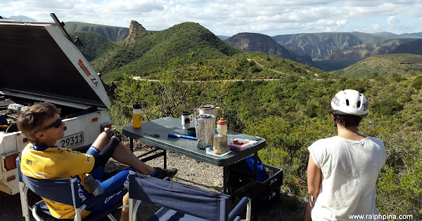
Day 4: Willowmore to El Yolo – 76 km
Rest Day in Prince Albert
Day 5: Prince Albert to Kruisrivier over Swartberg Pass – 52 km
Day 6: Over Rooiberg Pass to Vanwyksdorp – 39 km
Day 7: Seweweekspoort, down Bosluiskloof Pass to Gamkapoort – 45 km.
Download the Google Earth GPS track (.kmz)

Chris, Santie, Ralph, Magriet, Mitzi, Louis at Komdomo camp
This was the third such cycle tour along the rugged mountains that mark the southern rim of South Africa’s Great Karoo in the last three years. We organised it as a private tour, self-catered, camping mostly, with 6 riders and 2 drivers in two support vehicles.
Visit the Karoo MTB Tour 2015 photo album

Near the top of Swartberg Pass

Rooiberg Pass hairpin

Gamkapoort Dam
Afrikaans is an expressive and highly descriptive language. Here are some rough translations of some of the place names:
Baviaanskloof – “baboon gorge”
Rooihoek – “red corner”
Doringkloof – “thorn gorge”
Duiwekloof – “pigeon gorge”
Rooiberg – “red mountain”
Seweweekspoort – “seven weeks gap”
Bosluiskloof – “tick gorge”
Discover more from Ralph Pina
Subscribe to get the latest posts sent to your email.
Hi Ralph,
Looks like an amazing trip. Is the Gamkaskloof dam the actual “Die Hel” Gamkaskloof?
Hi Andre, the Gamka river and kloof cross Die Hel. It is possible to hike from the dam wall into Die Hel. Not for bikes though.